Cartography, from the Greek χάρτης khartēs (map); and γράφειν graphein (write), consistently defined as the art and science of rendering a graphic representation of a geographical area.
Good map design is the result of that tension between art and science; that it is the map's visual luxury that will attract attention to the story it tells.
I've been producing innovative and award-winning map products since 2012. I am passionate about providing cartographic services to a wide variety of clients, tailoring map communication to the needs of any project.
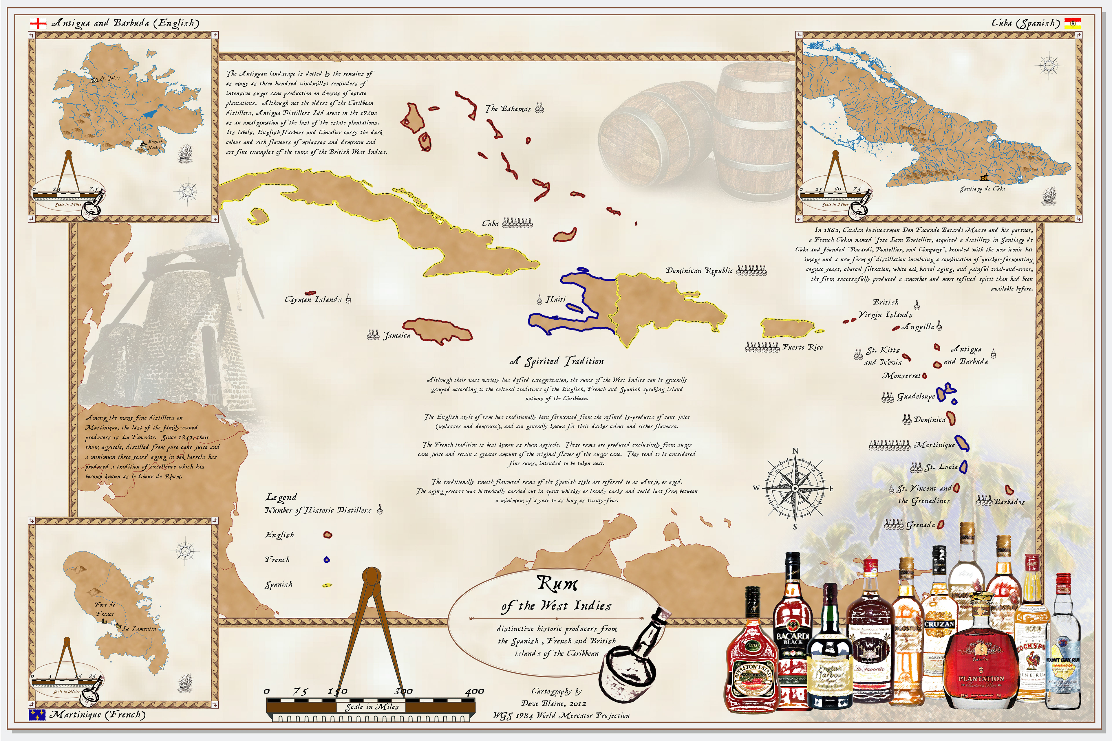
For this project the production of rums had to be classified and presented in a creative and stylized way. The challenge was that rum, in all its great variety, defies classification. I decided to focus on the origins of rum making, and chose broad categories according to historical colonial traditions. The result was a map presented in an historic style, with the most distinctive producers of each tradition were highlighted.
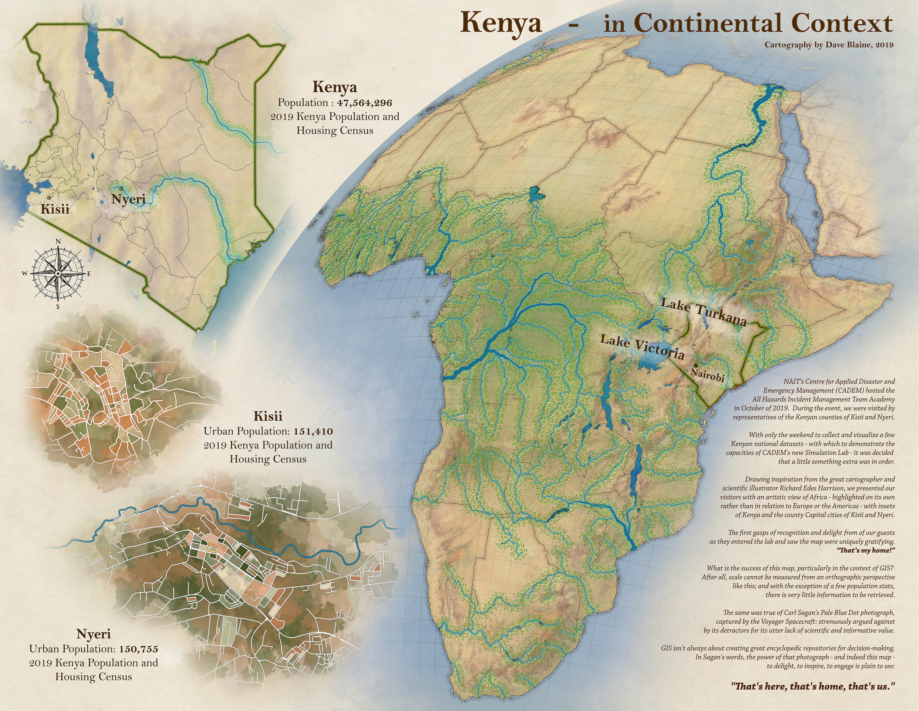
NAIT (Northern Alberta Institute of Technology) was hosting a visiting delegation from Kenya and for their tour of our facility I wanted to do something special. I decided to make them a gift of this map.
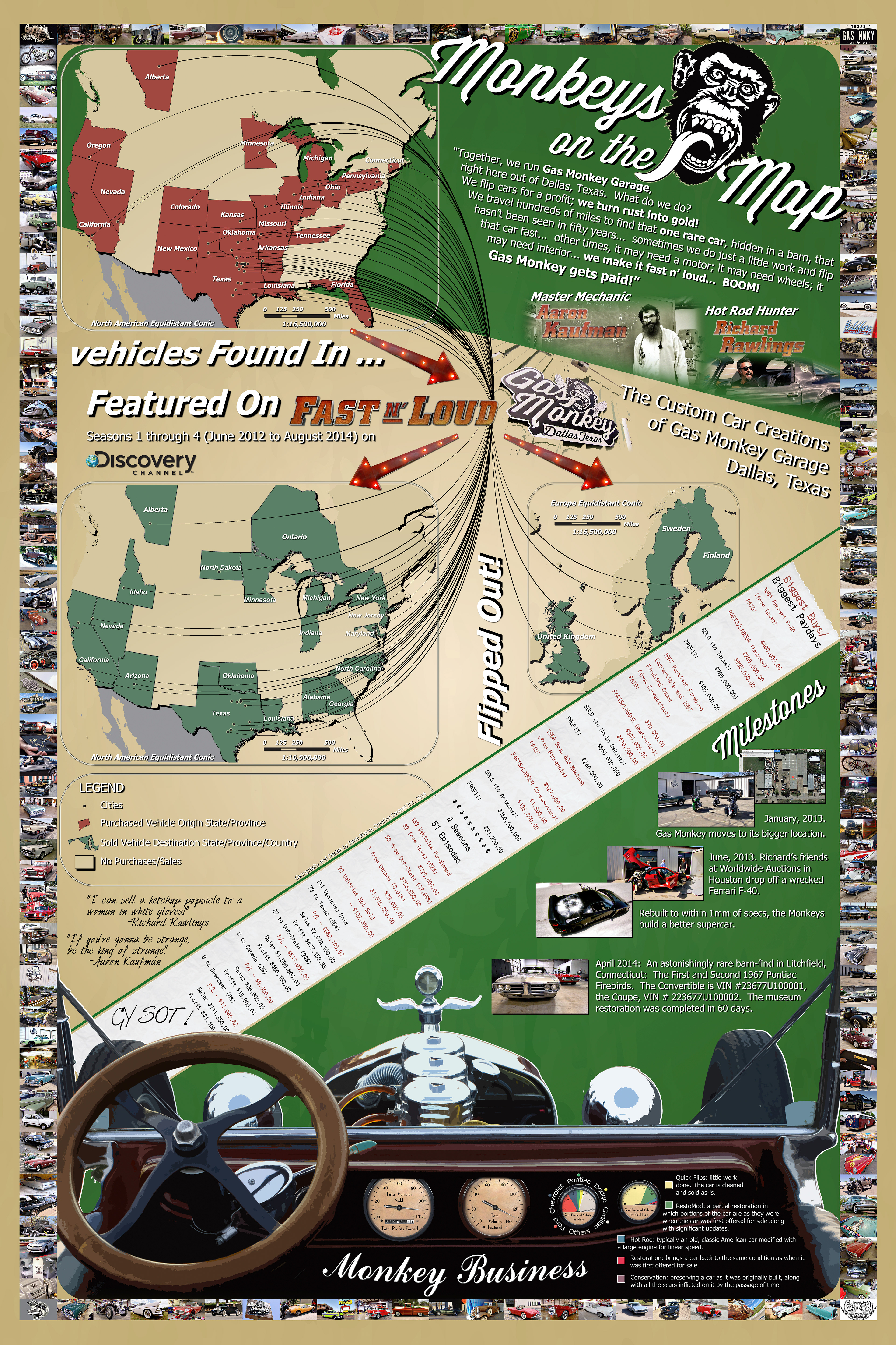
Total guilty pleasure, this one. Depicting the purchases, restorations and sales of modern, classic, and antique cars as seen on Discovery’s Fast N Loud, the map incorporates infographics and design consistent with the style of the show.
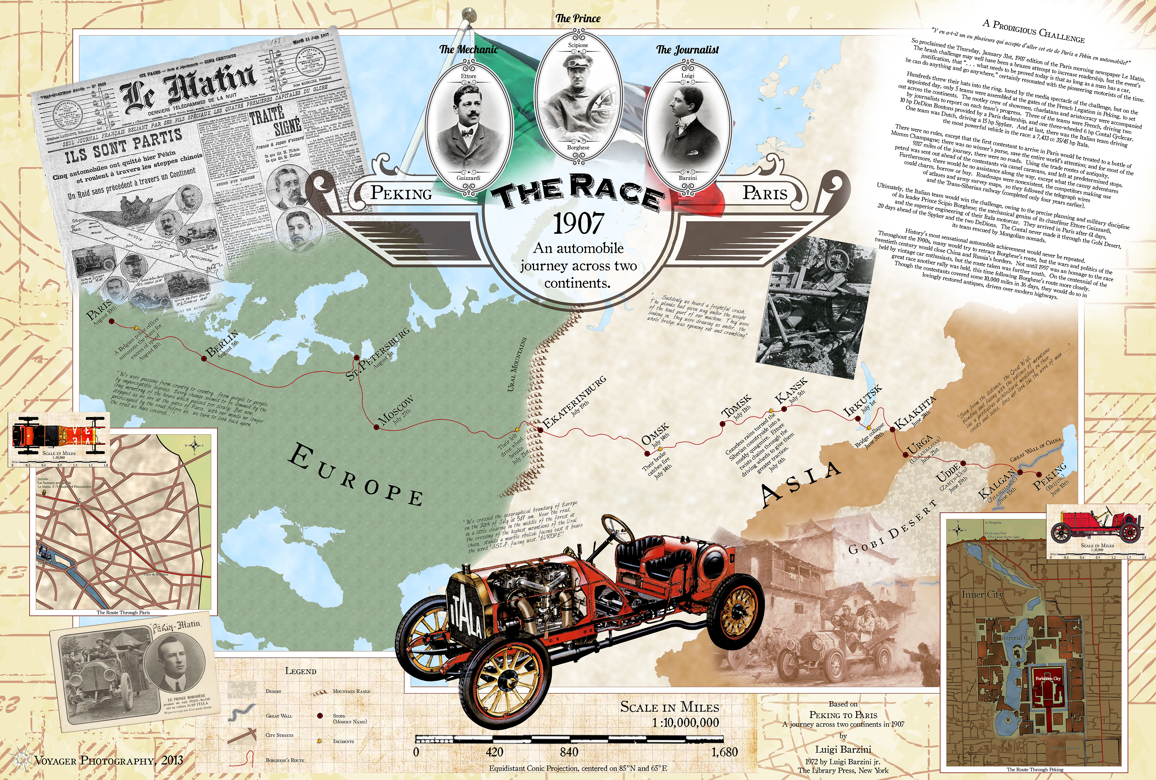
This project retraces the route of the historic Peking to Paris rally of 1907. The map incorporates street maps of old Peking and Paris digitized from historic sources, and map projections consistent with turn-of-the 20th century cartographic practice.
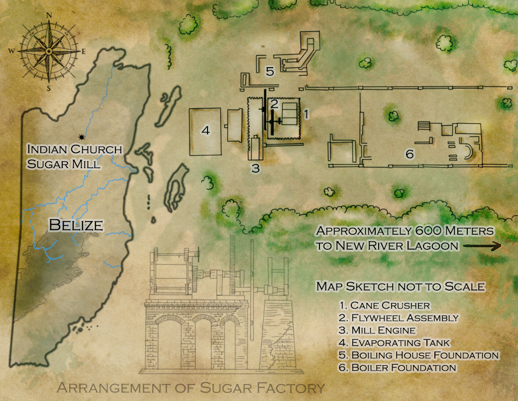
Part of a series of maps detailing sugar heritage sites in Belize, this one maps the layout of the Indian Church Sugar Mill at the Lamanai Archaeological Preserve in Belize.
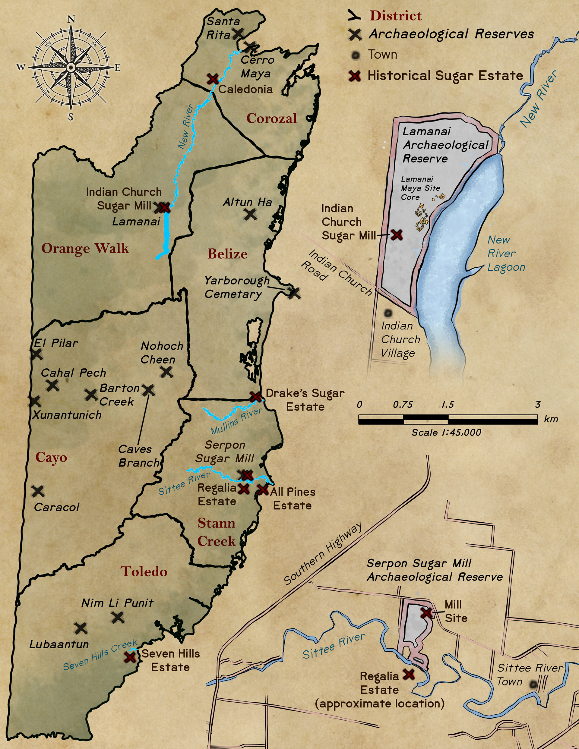
Sugar Heritage sites are scattered throughout Belize.
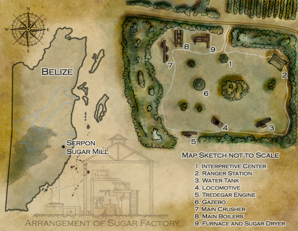
This map details the layout of the Serpon Sugar Mill Archaeological Preserve in Belize
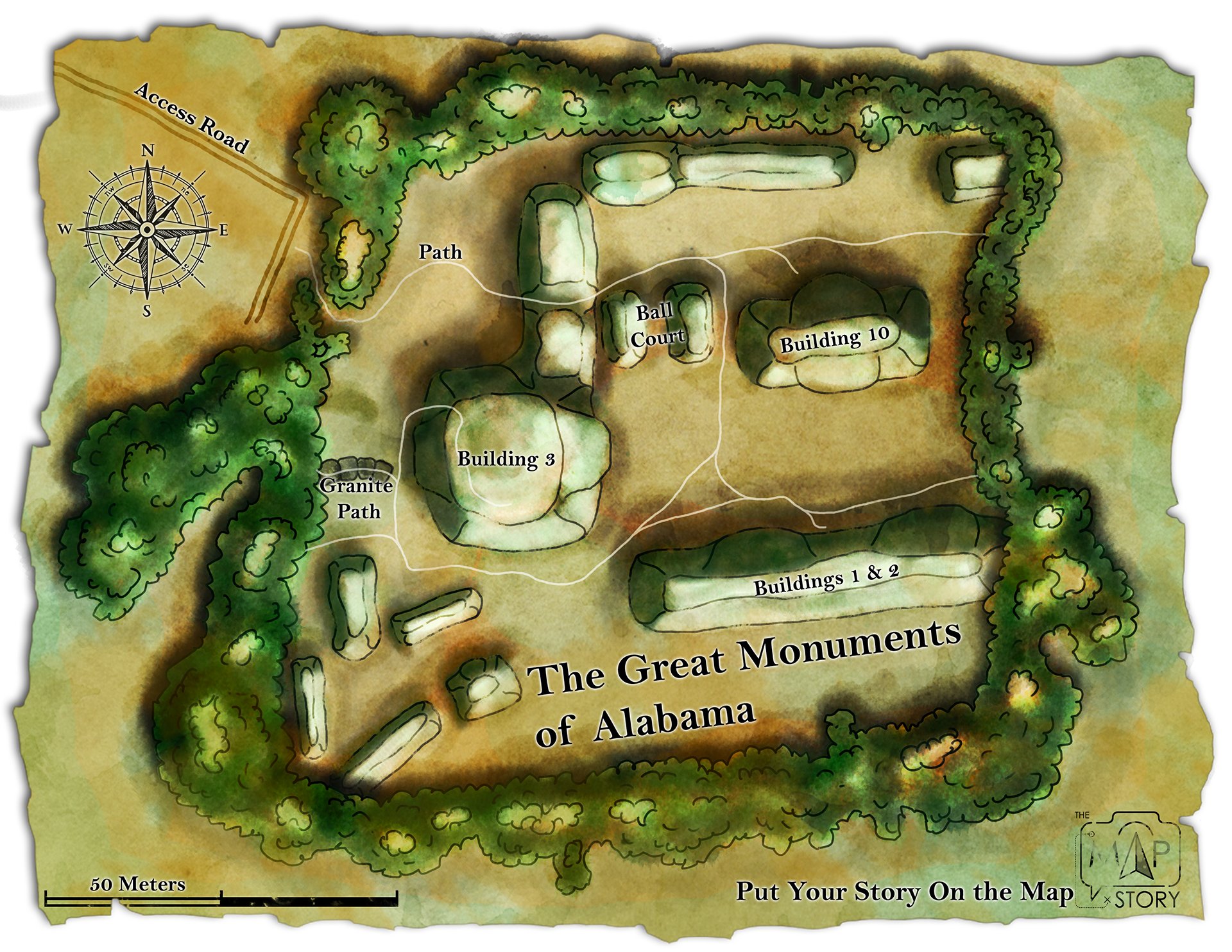
Alabama Site, 2018. Stann Creek Regional Archaeology Project
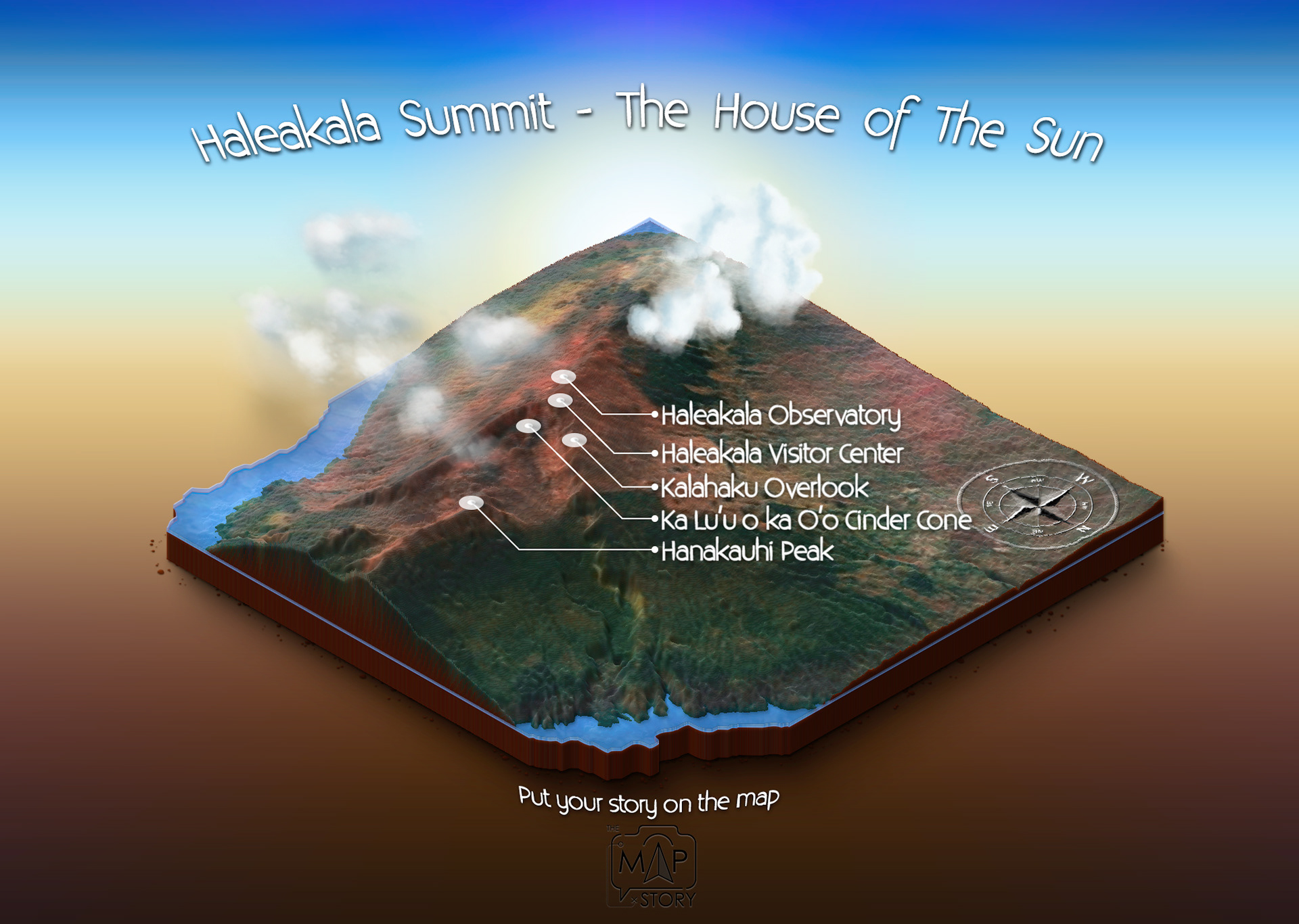
My first crack at making a 3D isometric map of Haleakala Summit.
Fun story about making this map: I hadn't used my Wacom Tablet in ages. Even considered mothballing it a few times... I'm glad I thought better of it because hand drawing this old-style map was a blast!
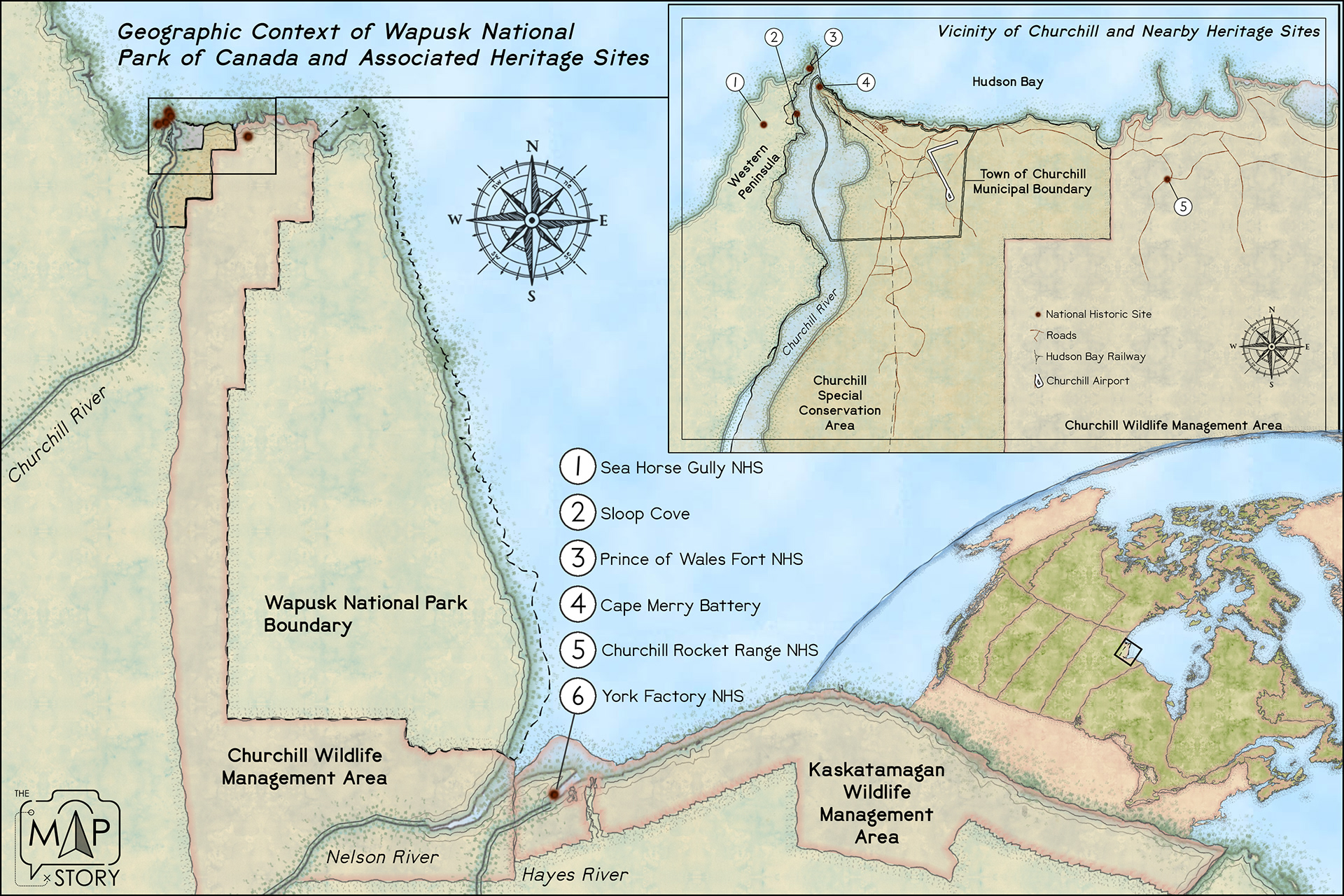
A map project detailing heritage resources and protected areas in the vicinity of Churchill, Manitoba.
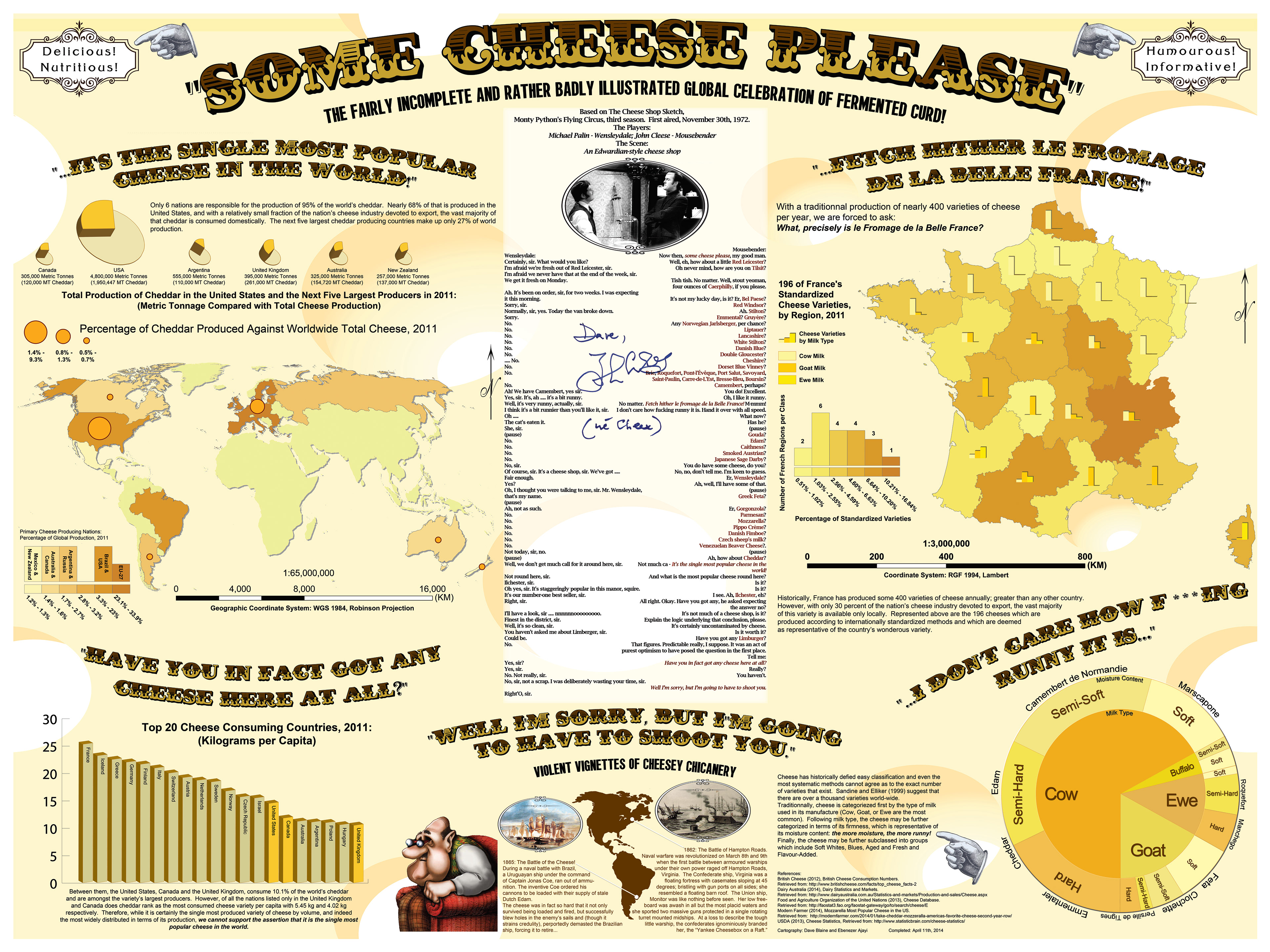
I made this map as a final project for my GIS studies. Totally rediculous, and one of my absolute favourites, when I had the chance to show it to John Cleese at the 2022 Calgary Comic and Entertainment Expo, I couldn't resist. Signed by the great man himself, it reads, "Dave, John Cleese (née Cheese).
Web Mapping
Geographic Information Systems (GIS) is about more than just analyses that support awareness and decision making. It takes creativity to broaden the spectrum of GIS to include communication, cartography and visualization. While I delight in creating traditional static maps, the web offers a venue of even greater reach; broader audience; and more immersive options for creating and sharing our stories.
Click the photos below to visit my online storymaps.
Mapping Northern Landscapes
In the summer of 2022, I satrted a 3-year project to map sensitive natural and cultural landscapes in the Northwest Territories. And what better way to kick things off – and really get to know our collaborators – than with a solid week of fieldwork?
I’d spent the previous few months collecting and compiling reams of official data from the Government of the Northwest Territories into an interactive web-mapping application as a proof-of-concept for this project, but there’s an old saying that the map is not the territory, so when the opportunity presented itself to collaborate with our partner – the Sahtú Renewable Resources Board – on a related project documenting the social history of Oil and Gas exploration in the region around Norman Wells, I leapt at the chance. After all that’s what the first year of this project is about, and it turns out the word we chose to describe it couldn’t have been bettered.
This Discovery Phase has already shed light on a huge part of the country I knew so embarrassingly little about. The Northwest Territories is a place of jarring extremes, where beauty and ugliness; tradition and modernity; ceaseless industrial noise and monastic tranquility were often found only a few kilometers from each other. Now at least, the peoples and places at the top of the world are a little less of a mystery, and much more of a revelation.
This is just the beginning of a year of discovery.
Confronting Green Colonialism
This story documents the kickoff of an Indigenous-led, globally connected initiative focused on food-water-energy sustainability and resistance to green colonialism.
Through shared knowledge, creative documentation, and collective reflection, our meeting gathered Indigenous scholars, researchers, and collaborators to share regional case studies, align methodologies, and co-develop the project's conceptual framework.
Two Hours in Old Town
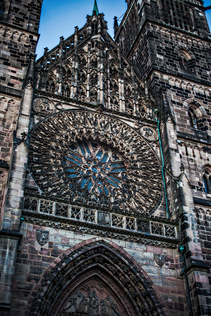
The west façade of St. Lorenz – the largest and arguably most majestic church in Nuremberg – is covered with intricate carvings and dominated by the stunning Rose Window; almost 30 feet in diameter.
Some years ago I visited Nuremberg during a rediculous business trip. With few, if any opportunities to just slow down and take in where I was, when a chance to just get lost for a bit presented itself, I took it for all it was worth!